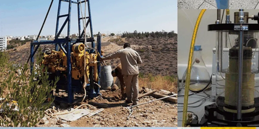
The Red River Valley doesn't forgive assumptions. Beneath Fargo's flat topography lie up to 30 meters of glaciolacustrine Lake Agassiz sediments—high-plasticity clays and silts with seasonal volume changes exceeding 15 cm. A soil mechanics study here has to quantify more than bearing capacity: it must resolve heave potential, consolidation settlement under long-term loading, and shear strength loss during the spring thaw. The city's frost depth reaches 1.8 m (72 inches), and the water table sits just 1.5 to 2.5 m below grade across much of Cass County. These conditions demand a program that integrates undisturbed Shelby tube sampling with laboratory triaxial testing and index property classification per ASTM D2487. Before layout decisions lock in, we typically recommend coupling the lab program with field CPT testing to map the continuous stratigraphy without sample disturbance, and Atterberg limits to bracket the plasticity range that governs shrink-swell behavior in Fargo's lean and fat clays.
Fargo's Lake Agassiz clays can lose 40% of their undrained shear strength during the spring thaw—lab consolidation and triaxial data are not optional here.