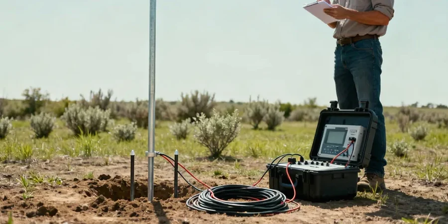
Fargo's built environment sits squarely on the lacustrine clays and silts of glacial Lake Agassiz — a flat, featureless plain that masks a surprisingly complex stratigraphy beneath the surface. The city's expansion into West Fargo and the revitalization along the Red River corridor has pushed site investigations beyond what a conventional grid of borings can efficiently resolve. We started integrating electrical resistivity tomography and vertical electrical sounding (VES) into our workflow back when the Sanford Medical Center expansion demanded continuous profiles between widely spaced geotechnical boreholes. The clay here — that infamous Lake Agassiz fat clay — holds a resistivity signature between 5 and 20 ohm-m when saturated, and that's a gift for anyone running a Schlumberger array across a 200-meter spread. It means you can trace clay thickness, pinpoint sand lenses that'd be missed by a 50-foot boring spacing, and map the water table without digging a single test pit. Over in the Oxbow neighborhood, where fine sands interfinger with the clays, we've seen VES pick up a 3-meter sand channel at 12 meters depth that three SPT borings in a 30-meter triangle completely walked past. That's the power of a continuous geoelectric section in this geology.
In Lake Agassiz clays, a resistivity inversion doesn't just suggest stratigraphy — it maps the water table, the sand lenses, and the clay thickness in a single continuous profile.